
")
From the book "Straight to the South", part 1 "Expedition to the heart of Sri Lanka", episode 2.
| 07 and 09.03.2018 | 7°57'55.62"N 80°45'42.82"E |
We had only three full days in Sri Lanka. It is quite a bit and we did not drive to the sea and decided to spend them in the Central province, near the city of Dambulla. Local places are steeped in history. Enough to say that ancient inhabitants of the island belonged to the Veddo-Australoid race, bringing together representatives of the Australian and Veddoid or Ceylon-Sunda lesser races. Scientists believe that these peoples were the first human group who leaved Africa (the ancestral home of mankind) in the stone age and settled part of South and South-East Asia and the Eastern part of the tropical belt of the Old World, from Hindustan to Indochina and the Malay archipelago, and even to Australia. At the same time, they are genetically isolated from Europeoids and Mongoloids and do not have common ancestors with Negroids, some resemblance to the Negroids can only be explained by living in similar climate conditions. And then people who settled the island of Sri Lanka had a lot of interesting ...
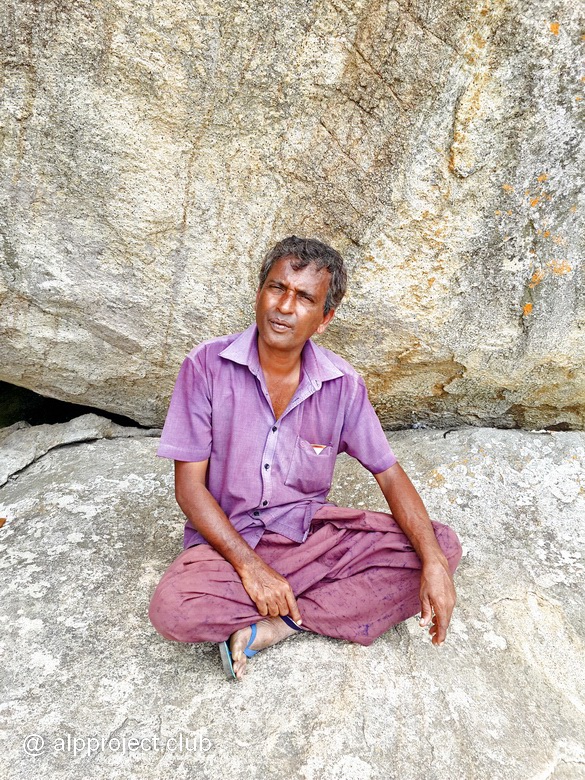
Small family hotel Sigiri Rock Side Home Stay (7°56'57.67"N 80°45'17.89"E, that in the vicinity of the ancient city of Sigiriya) was clean and cozy. The Breakfast room cost for us about USD 35 per night. In the mornings we were woken up by wild monkeys jumping on a roof, the hospitable hostess treated us with freshly prepared dishes - pancakes and cakes of roti with tasty sauces, scrambled eggs, fresh fruits and the owner, the archaeologist and the local historian, helped us to organize hikes on vicinities .
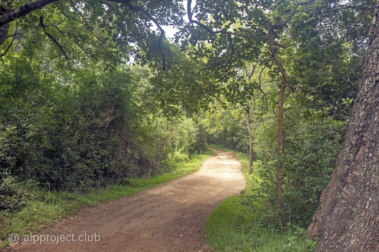
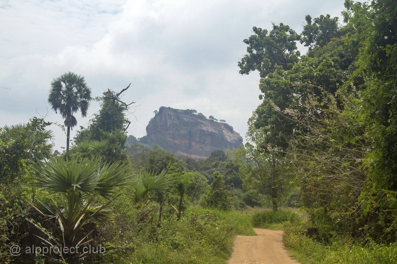
The road to our hotel
A a small village, which also called Sigiriya, was located in 10-minute-walk from our shelter along the road. There are cafes, souvenir shops, ATM and even a massage parlor there - civilization, in one word. We chose one of the restaurants and went there for dinner - tasty, inexpensive and beer :)
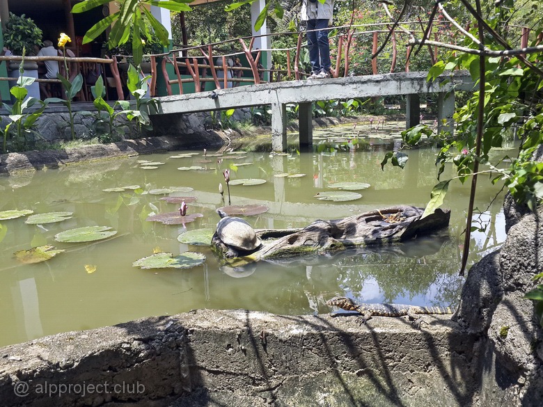
River turtle and lizard in the pond near a small restaurant
"Sigiriya" is translated from Sinhala, the Sanskrit language of the largest ethnic group in Sri Lanka, as "Lion rock". This rock, in honor of which the city was named, is an oval in plan granite pedestal with vertical walls and a flat top – a plateau whose height is 370 meters above sea level and about 170 meters above the surrounding plain. More about this unique top we will tell you later.
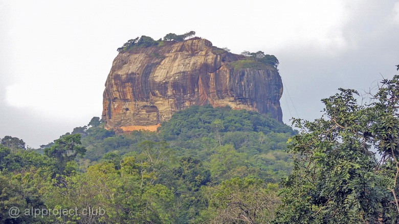
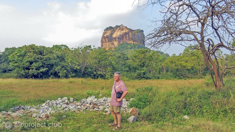
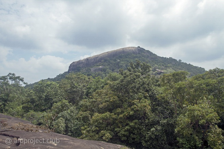
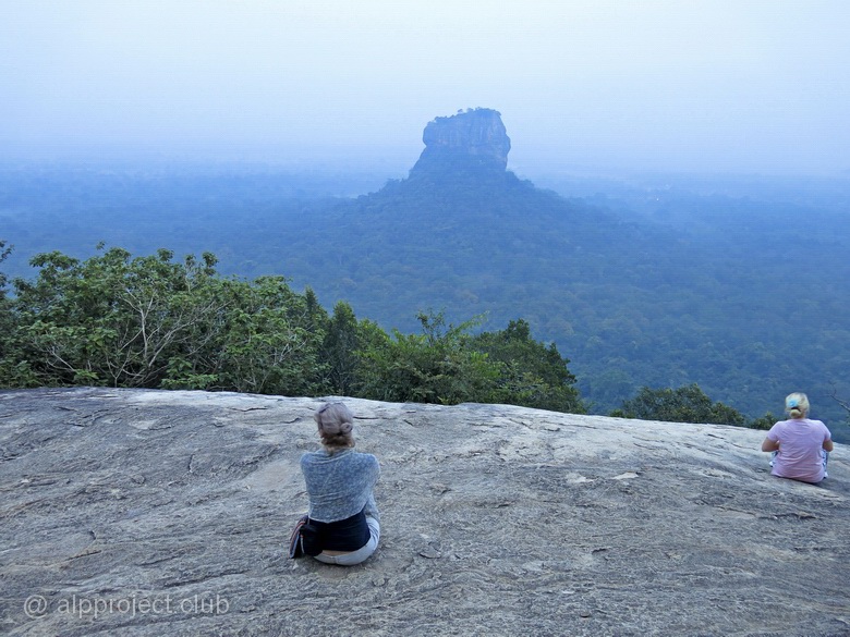
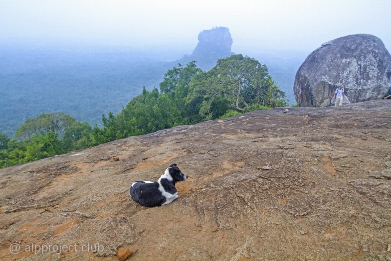
Views to Sigiriya mountain from the South-West
The first day we (tired after the flight and the night on the road) focused to another object. To the North of the famous Sigiriya rock there is another rocky ledge, it is called Pidurangala, which translates as "donated Golden rock". However, tourists from all over the world, willingly visiting Sri Lanka, this mountain is somehow less popular than its neighbor. Despite the fact that view from Pidurangala to Sigiriya is really breathtaking one...
We hired a tuk-tuk (a scooter with an awning and seats) and went there. The distance from the main road is 4 kilometers, the journey time is 15 minutes, the right price is 200, well, up to 300 Lankan rupees.
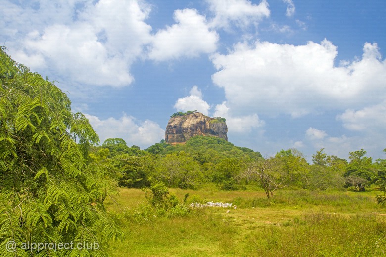
Views of Sigiriya from the Northwest
Cover of the scientist-naturalist who observes the migration of elephants
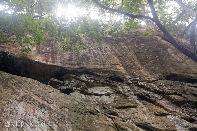
Base rocks here represent the Foundation of the ancient continent of Gondwana, which split hundreds of millions of years ago into several separate plates. One of them is Indian, and Sri Lanka, which Europeans used to call Ceylon, is a fragment of it. Somewhen in the Paleozoic or Mesozoic an intrusive stock penetrated here along deep fault, thereby forming a hill on the plain, young granites are in the core of which and ancient rocks are on the slopes and at the foot of it – gneisses and crystalline schists. And here we tread under our feet the rocks, whose age is 4-5 billion years old, think about it…
The ancient gneiss
Dredging in stone - a source of fresh water for a traveler
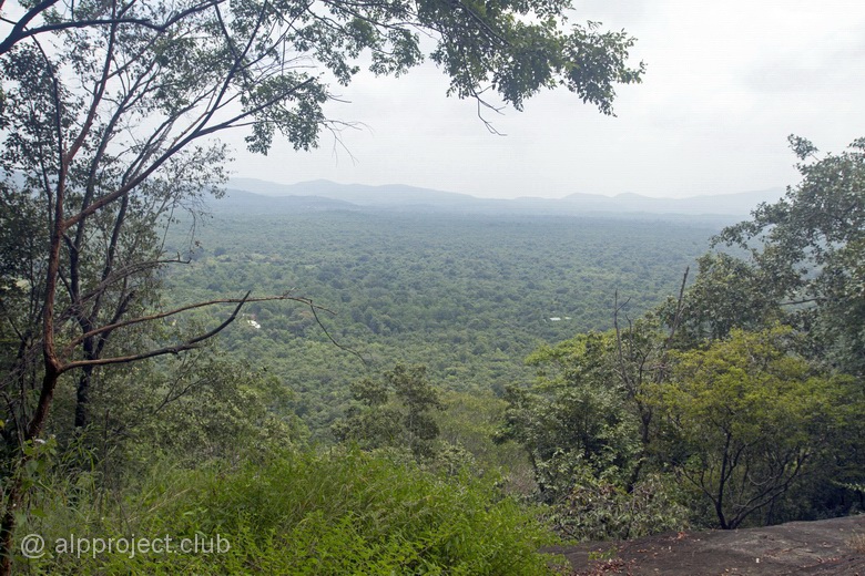
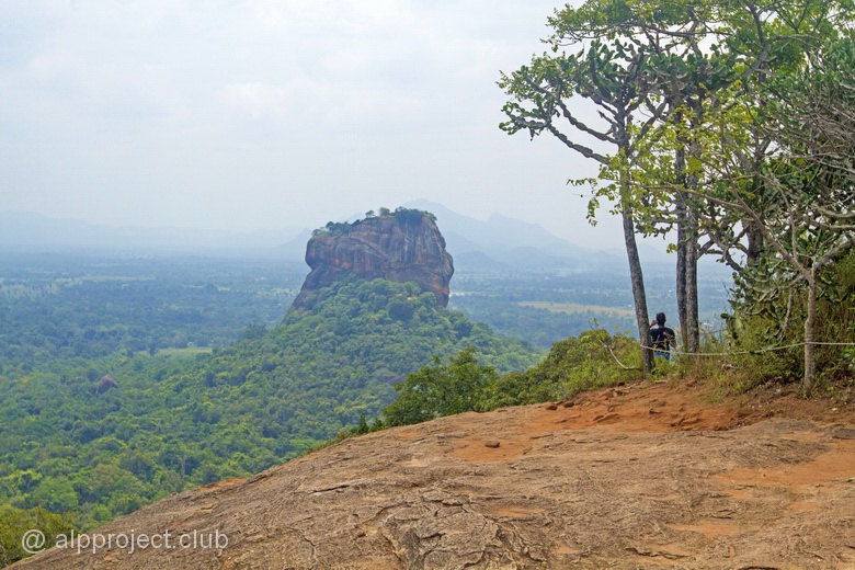
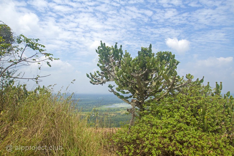
View of Pidurangala mountain from the West
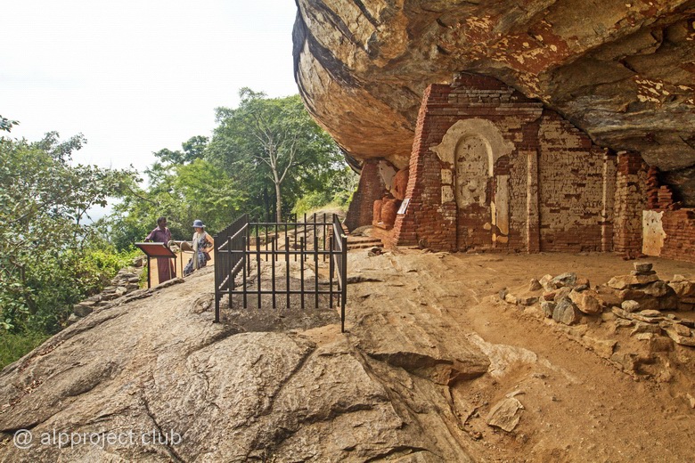
The history of the local Buddhist sanctuary is also ancient. Not so ancient, of course, but in comparison with the life of one person is quite a significant. Scientists claim that it originated in the III century BC and to this day monks rise to the statue of the reclining Buddha to offer prayers and meditate. There is a working monastery at the foot of the mountain.
Sculptures located in it, including several statues of Buddha, are modern but there is an old fresco with figures of Busty young ladies ("heavenly maidens") on the wall above the entrance to the chapel, the same as the world-famous and UNESCO-protected images in the grottoes of Sigiriya.
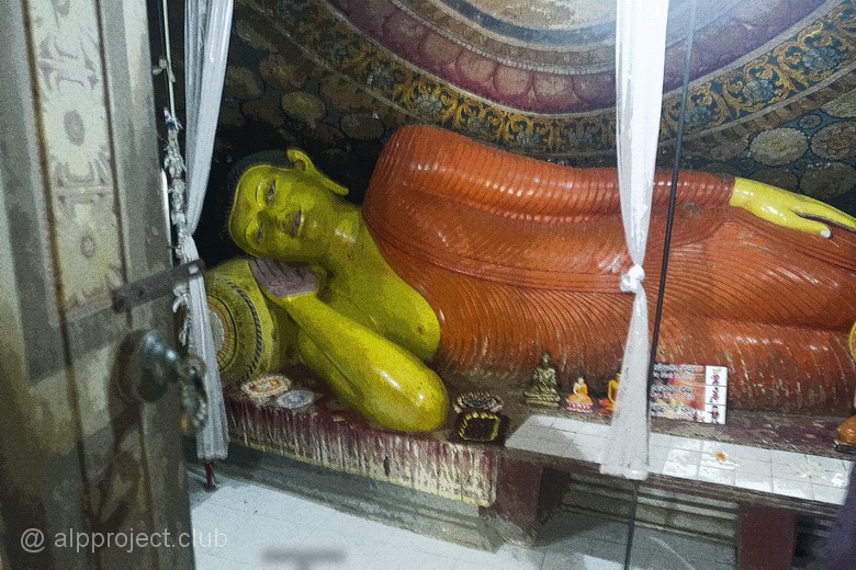
Sculpture of the reclining Buddha in the chapel of the temple at the foot of Pidurangala (modern)
A few meters from the temple a long stone staircase begins leading to the top of Pidurangala. There are the rock on the rise to the right of it and scenic views of the valley on the left of the tree branches..
The journey takes 20-30 minutes briskly, the way lies in the shade of the large old fig trees.
< br /> The trail leads to a rocky shelf at the base of which in the grotto under the eaves the Buddha lay down to rest.
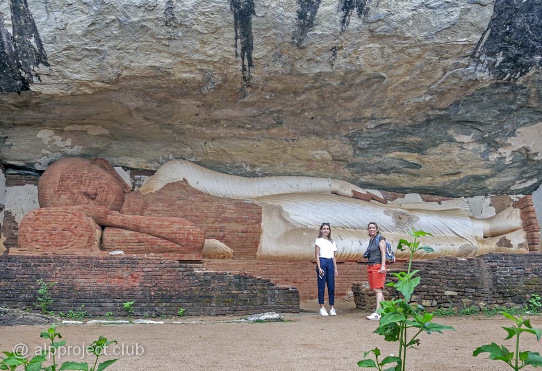
The giant statue is 14.5 meters long, it is the same age as the famous Palace built by king Kashyapa I in the neighboring Sigiriya, it is the V century AD. The upper part of the sculpture is made of fresh brick, it is the restoration of the XX century after black archaeologists destroyed it in search of treasures. Treasure, by the way, the robbers found, it was hidden in the head and chest of the Buddha. All other parts are old, where they are covered with white plaster.
A stone inscription protected by an iron fence was scraped out in the language of brahmi, one of the oldest varieties of Indian syllabic writing, by a monk more than two thousand years ago. What's written? Something like: "I lived and prayed here.." The tradition of leaving a memory in the inscriptions on the stone is ancient :)
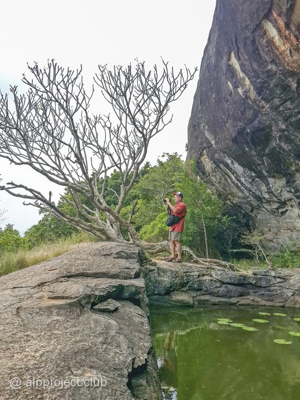
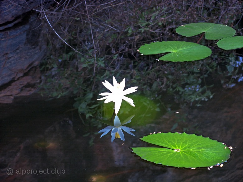
Next to the lying Buddha there is a lake with green water, where fish, frogs and even a small snake swim. The internet reports that monks cut down this artificial reservoir 2100 — 2300 years ago in rock base as a source of fresh water. Water quality is questionable, as you can see, but there is no other one on the mountain :)
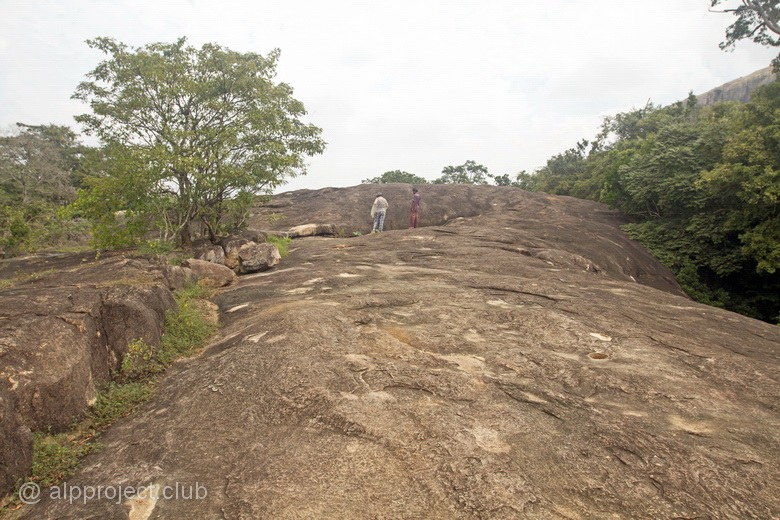
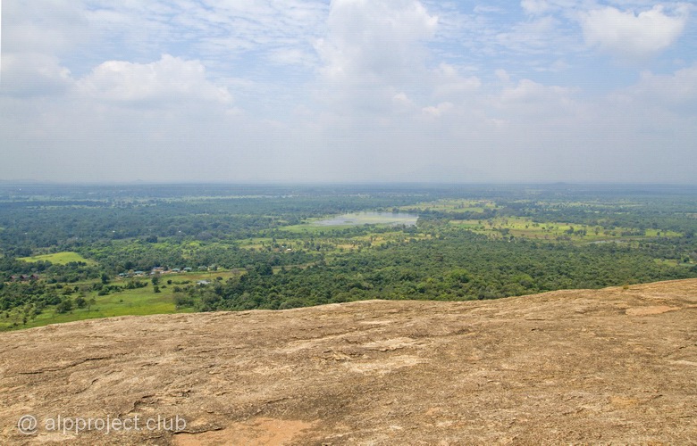
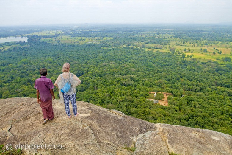
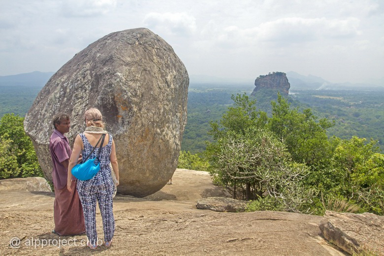
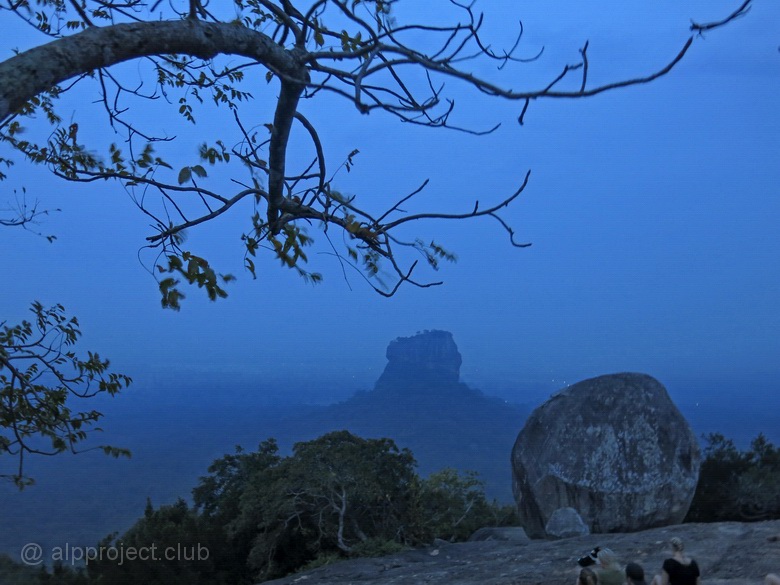
From the statue the trail goes up among the stone boulders. Narrow passage is littered with large rocks and it locates is the end of the ascent, where you have to go up crawling on your belly. But after that you get to the ground at the base of a hefty block of stone, which offers a long-awaited view of Sigiriya..
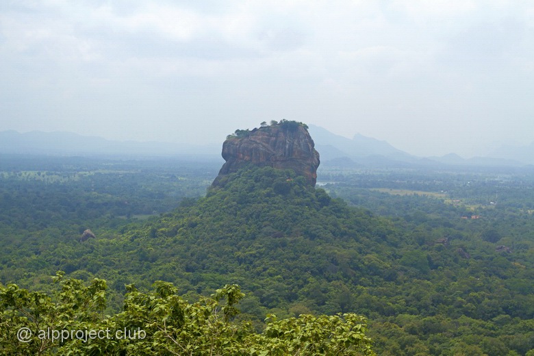
Weather was not the most successful, haze hungs but view was spectacular.
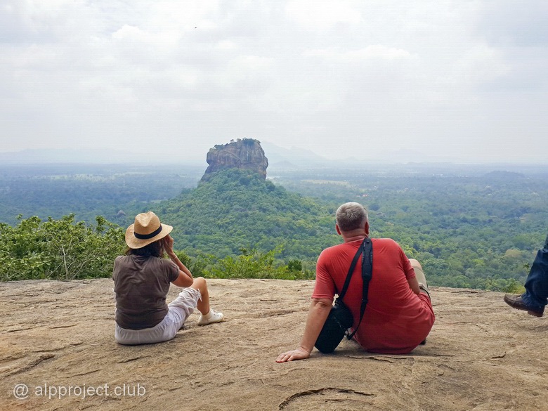
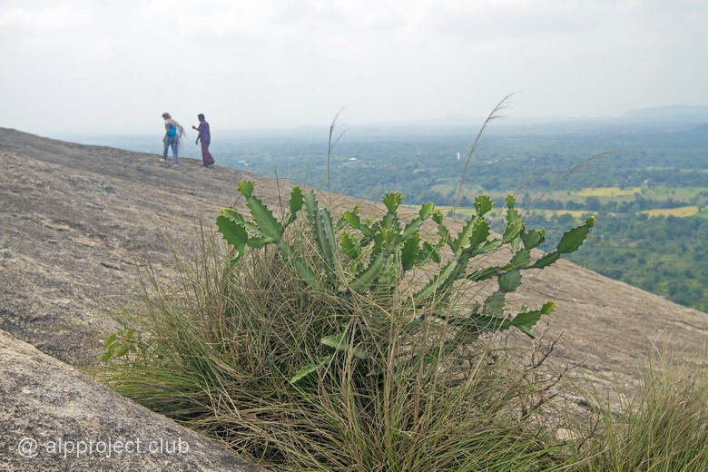
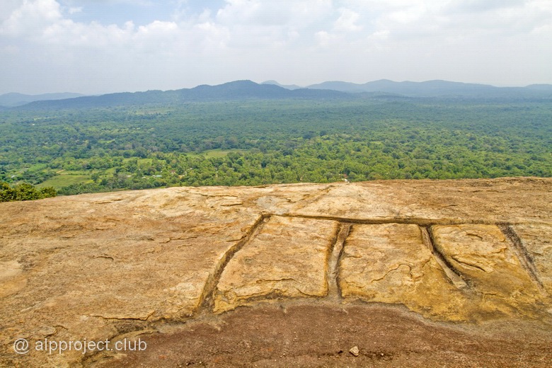
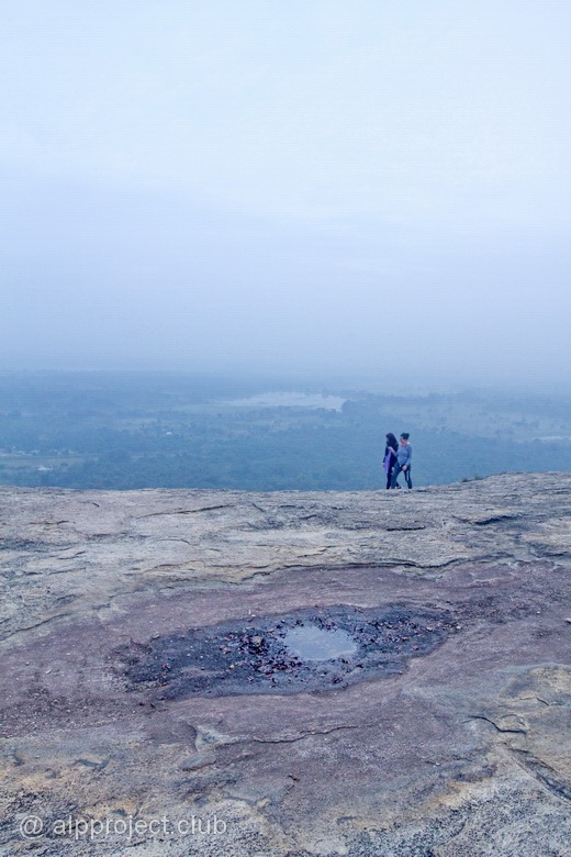
The top of the rock is almost flat, it is easy to walk on it, enjoying the open views of the surrounding area.

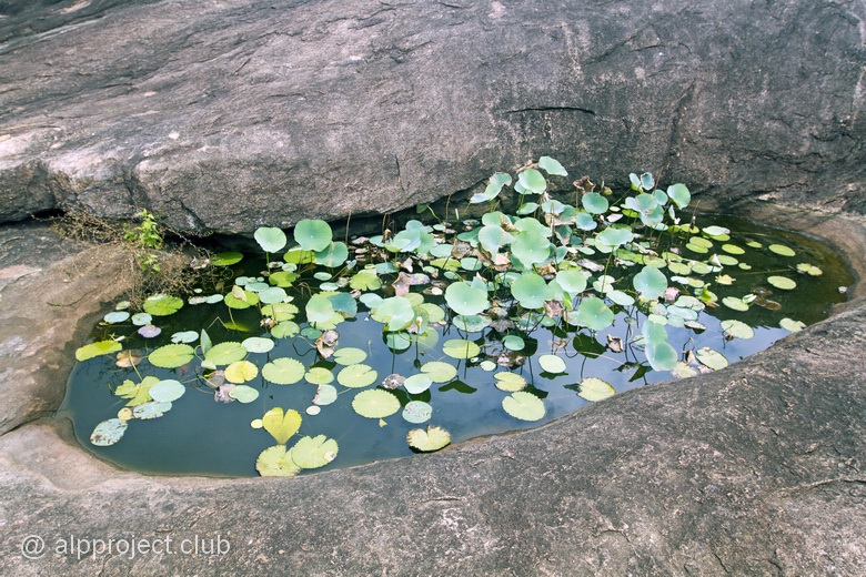
Long ago here were monks ' cells too, their foundations could be found in some places. And here is how they solved a water supply problem: channels were cutted in a stone - rain water flows down by them to a small puddle
On the 9th of March, the last day of our stay in Sigiriya, we woke up early in the morning and went to Pidurangala to meet the dawn. The trail rose in the darkness by the light of lanterns, risking to break feet. We reached the top when it was still darkbess around..
We expected to meditate in peace and solitude - no way! Anon a crowd of fans of the morning scenery and romance was gathered, they speak a lot languages of the world!
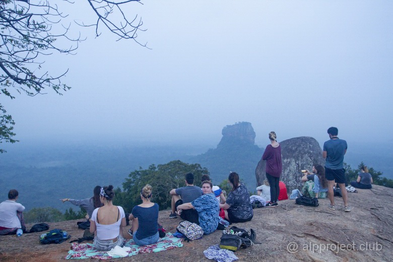
And the sun, unfortunately, disappoint us, it rose in continuous clouds and we didn't see it and we admired only foggy morning. Not bright, but beauty..
Look at our short movie about how we saw Pidurangala mountain:
< episode 1 |
episode 3 > |