
")
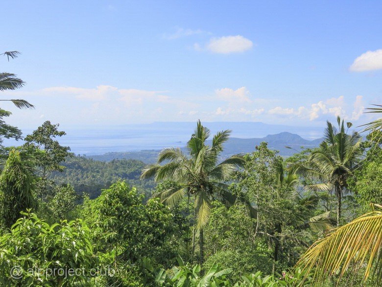
Bali island is a part of the island arc that separates the inland sea and the open Indian ocean, next to it the oceanic plate dives under the continental plate, so earthquakes and volcanic eruptions is a common thing here. But natural disasters do not scare tourists from all over the world, they practically occupied this island paradise. They are attracted by the unique nature, by the sea, by the abundance of different attractions and the friendliness of local residents, and local relative cheapness plays a significant role. This is probably the most visited of the resorts in Indonesia. And it is a convenient connecting hub, the local international airport receives flights from many countries and you can fly to other islands from here by local airlines. That's why we visited Bali a few times making few days stops and we have accumulated a large number of data - travel notes, photos and videos, so we should to publish some of them. There is an interactive guide just below this paragraph, which could be interesting for people who want to go to Bali and who have already been there (sometimes it is interesting to look at familiar places by eyes of another person). You can travel around the map - by clicking on the icon you will open our article about this particular place with photos and short movies.
Or you can use the table of contents below and choose what are you interesting about. Or you can just use the arrow button "next" at the end of each page and read the book sequentially..
So, let's start the journey, we hope it will be interesting.
West
• Pemuteran, Kubuku hotel• Menjangan - Deer island
• Menjangan, dive site Eel Garden
• Menjangan, dive site Pos II
• Menjangan, dive site Anchor Wreck
• Menjangan, dive site Dream Wall
• Menjangan, dive site Cave Point
• The West of the island, Gilimanuk, dive site Secret Bay
• Bali. Banjar Hot Springs
Central part
• The Batur volcano – Gunung Batur• Ubud – town of craftsmen
• Monkey forest
• Tegenungan waterfall
• The temple complex Batuan - Batuan Temple
• Bali Zoo
North-East
• Tulamben – USAT Liberty Wreck• Banyuning – Japanese Wreck
• Amed, Amed Beach Resort
• Amed, dive site Bobo (Pyramids)
• Amed, dive site Batu Belah
• Lampuan temple (Seraya volcano)
South-East
• The legend of Bali - beaches of Kuta• On the edge of the ocean: Uluwatu temple complex
• Dinner with a sunset view: Jimbaran beach
East
• Padang, dive site Blue lagoon• The muddy waters of Padang: the dive site Jepun Point
• To escape the bustle: Candidasa village
• Shark in the hole: divesite Gili Biaha
• Sea of corals: Gili Tepekong
• Against the tide: Gili Mimpang
• Who lives under the pier: the sea port Tanah Ampo
Nusa Penida
• Along the flow: dive site Ped• Couldn't catch the sun: dive site Toyapakeh
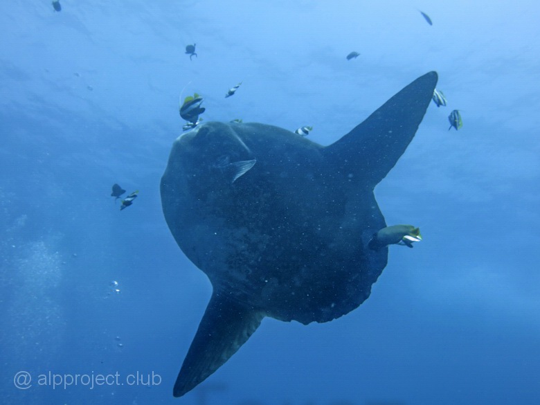
• Mola mola: the venue - Crystal Bay
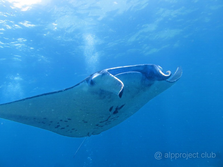
• Meeting with sea devils: Manta Point Baru
episode 1 > |
From the book "Bali Island", part 6 "Nusa Penida", episode 35.
8°47'44.10"S 115°31'33.40"E
Russian sailors who were pioneers of tropical waters called this relative of sharks as Sea devil. You can imagine what a superstitious horror they caused when this huge horned nightmare suddenly appears from the depths of the sea.. :-)
From the book "Bali Island", part 6 "Nusa Penida", episode 33.
8°41'0.60"S 115°28'57.70"E
There is North of the Nusa Penida island, Toyapakeh bay, where people arrive by boats and ferries from neighboring islands. You can see small island of Lembongan not far to the West. It is separated by not wide (up to 1km), but rather a deep strait, powerful cold currents come along it from the ocean to the Bali sea and sometimes they bring large inhabitants of the sea.
Eye to eye..
From the book "Bali Island", part 6 "Nusa Penida", episode 32.
8°40'30.00"S 115°30'52.80"E
Nusa Penida island is located closer to Lombok island then to Bali. But we will describe it in this section because almost all dive centers in Bali do arrange diving and snorkeling here, lovers of underwater world spend 20 minutes to come here by speedboats from the Padang Gulf.
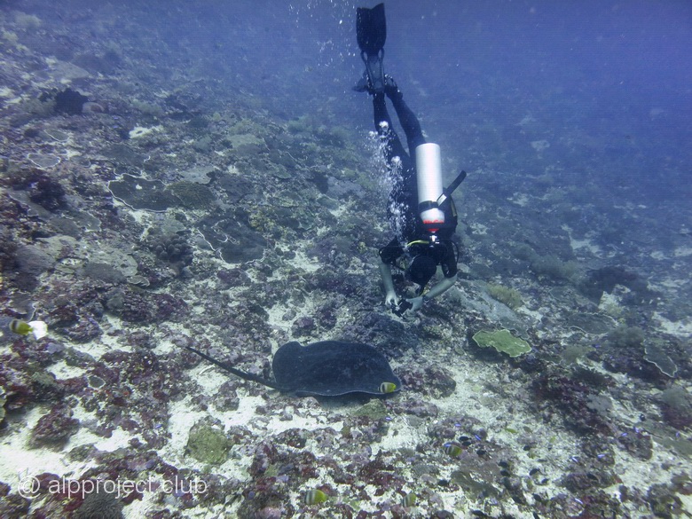
Drift along a gentle underwater wall on the North of Nusa Penida island. Our georeference is arbitrary – you can come much East or West – the essence remains the same: all the dive will be along the flow. We had short stops during the dive for shooting the main attractions of this site – corals and fish scurrying around them..
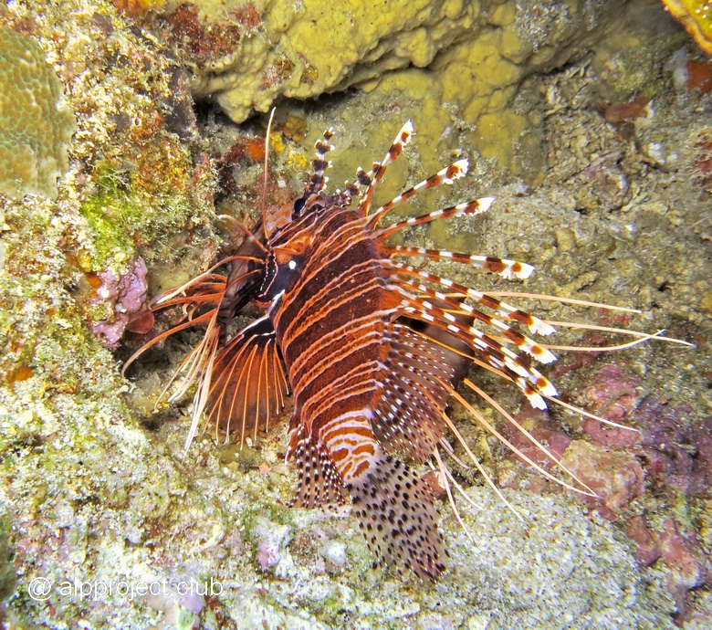
Lionfish
From the book "Bali Island", part 5 "East", episode 31.
8°30'29.81"S 115°31'8.07"E
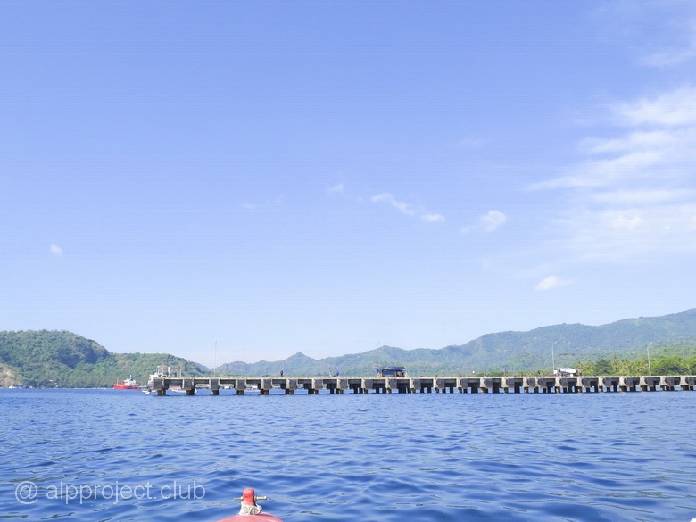
Tanah Ampo – sea port in the East of Bali, large cruise ships come here from Singapore and Australia. But we are interested by the pier, there are a lot of unique characters under it.
From the book "Bali Island", part 5 "East", episode 30.
8°31'30.58"S 115°34'34.98"E
Три крохотных островка рядом с Типиконгом, октябрь 2016 года. Годом раньше наши гиды встречали здесь рыбу-луну – мола-мола, но в этом году вода осенью была необычно тёплой, что гигантской рыбе не по нраву, она предпочитает прохладу.
Мы ныряли тут лишь один раз, весь дайв боролись с сильным течением. Не фотографировали, есть лишь видео. Персонажи в нём все известные, представлять никого не надо. Давайте понаблюдаем за ними: There are three tiny islands near Tepekong, October 2016. The year before our guides met here moon fish – Mola-Mola, but in this year the water was unusually warm that the giant fishes does not like, they prefer the coolness.
We dived here only once, the whole dive we were struggling with strong current. No photos, we got only video.All the characters in the movie are well known, it is not necessary to discribe anyone. Let's watch them: