")
From the book "Bali Island", part 2 "Central part", episode 13.
8°34'31.41"S 115°17'18.15"E
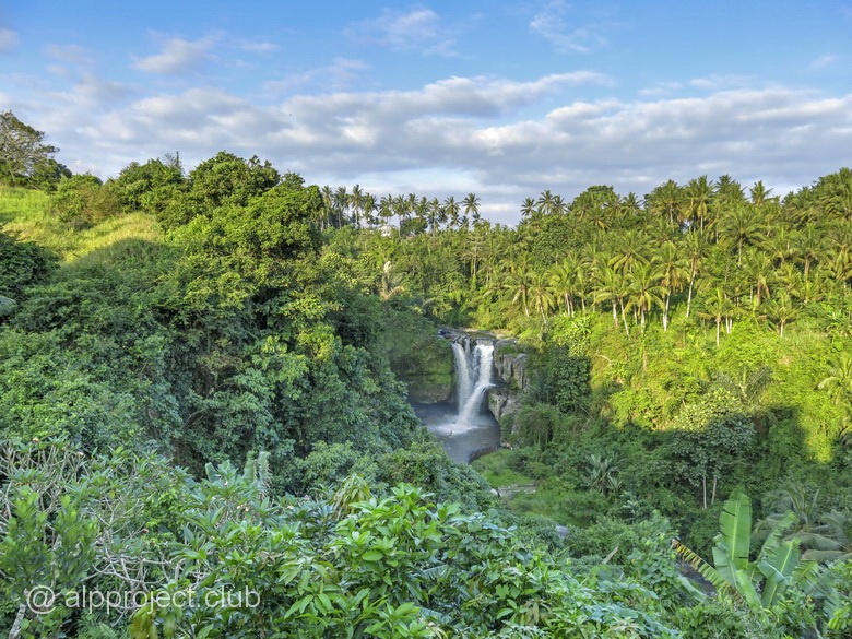
It's hiding in the jungle near Ubud. The road leads to the observation site with shops and restaurants, from where a steep and slippery wooden staircase descends to the water.
From the book "Bali Island", part 1 "West", episode 9.
8°12'43.52"S 114°57'51.84"E
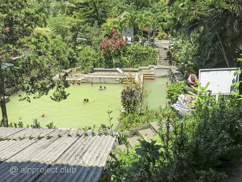
Traveling from the West to the center of Bali island, you can stop to bathe in the hot sulfur springs. There is small detour – 3-4 km from the main road. The resort is located to the South and above the village Banjar (Kota Banjar), about a kilometer from the village market. Look at the name "Banjar" - it is looks like Russian word "banya" which means Turkish bath. The place is really Turkish bath, to be honest :-) But, of course, springs are considered sacred and they decorated accordingly. Hot water with a noticeable odor of sulfur emanates from the mouth of the eight Nagas (mythical creatures like dragons) down to the long upper pool.
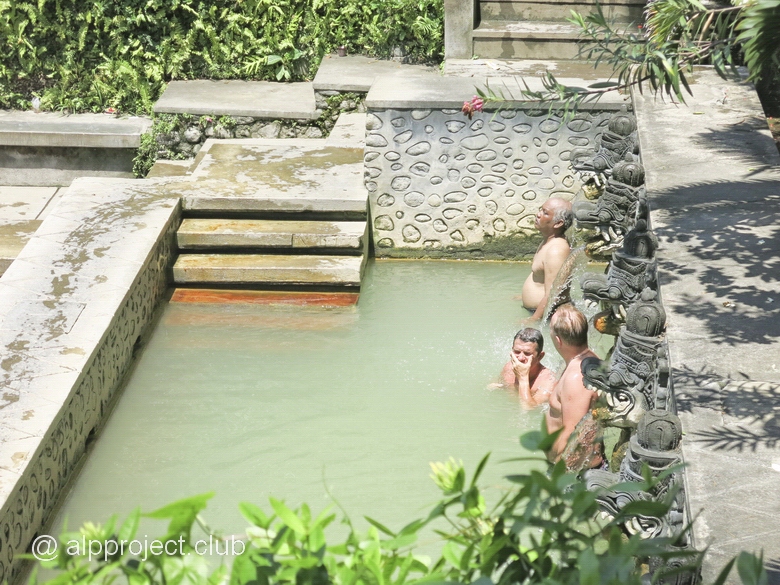
From there, water flows from the mouths of five of the Nagas in the next pool below. This pool is the largest of the three and has a square shape. The third pool is the smallest, water jets falling from a height of 4-5 meters, and you can make yourself a nice water massage there.
Small temple, surrounded by statues of gods, is hid in jungle where hot water pours from the cracks.
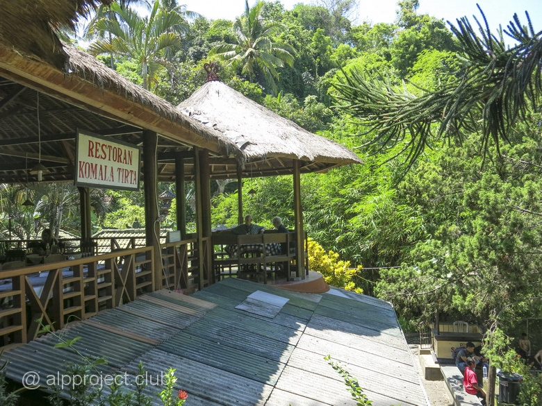
Also there is a small restaurant where you can quite reasonably eat.
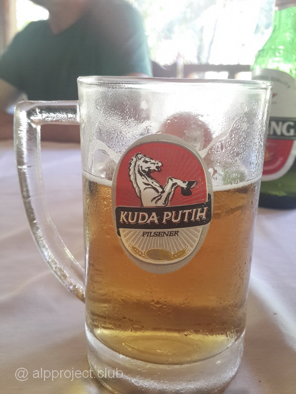
The name of this beer to the Russian ear sounds interesting :-) And actually the translation is "White horse", merely :-)
Souvenir market is located before the entrance to the baths. It is Holy cause – to purchase something near a Holy place! :-) And the people sometime purchase something there, not only tourists but local peole too..
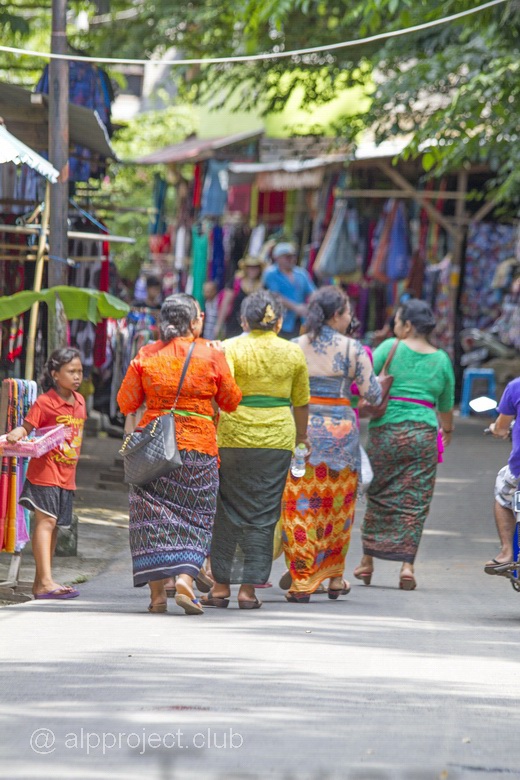
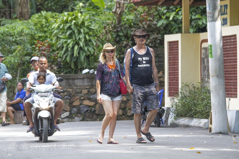
It's full of people there after 10 a.m. especially on weekends and holidays, so experts suggest to come here earlier.
For completeness, look at our short video:
< episode 8 |
episode 10 > |
From the book "Bali Island", part 1 "West", episode 7.
8° 6'4.34"S 114°31'18.98"E
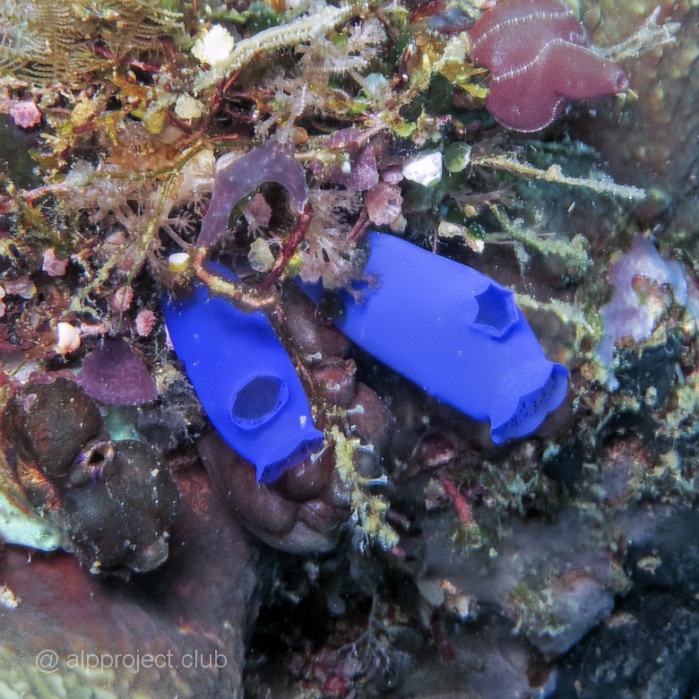
The South of the island. Thre is a wall of coastal coral reef riddled with caves and small tunnels up to 6 meters long each. Underwater visibility was better than on the Northern open side of the island. We drifted by the tide, it was not strong and frequently changed its direction. Interesting soft corals are growing on the wall..
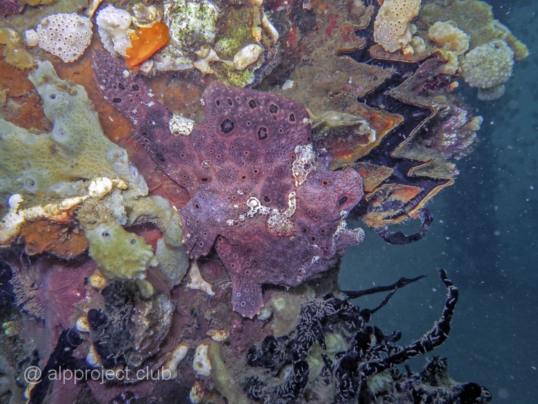
From the book "Bali Island", part 1 "West", episode 8.
8° 9'49.88"S 114°26'19.76"E
A unique place. The local underwater world differ from what can be seen in the open sea – the pool is almost closed, there are practically no waves and currents, and the water is colder, so those who like quietness and coolness live here. Such, primarily, frogfish. They usually live at depth, but they like so much the climate of this bay that they divorced here in abundance. Look at beauties we met there:
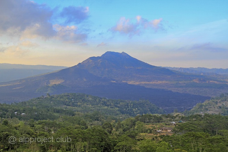
From the book "Bali Island", part 2 "Central part", episode 10.
8°17' 3.95"S 115°22' 9.29"E
Batur volcano, the Indonesian name is Gunung Batur. The outer caldera of the volcano was formed about half a million years ago, it is 13.5 by 10 km in diameter and reaches a height of 1717 meters above sea level.
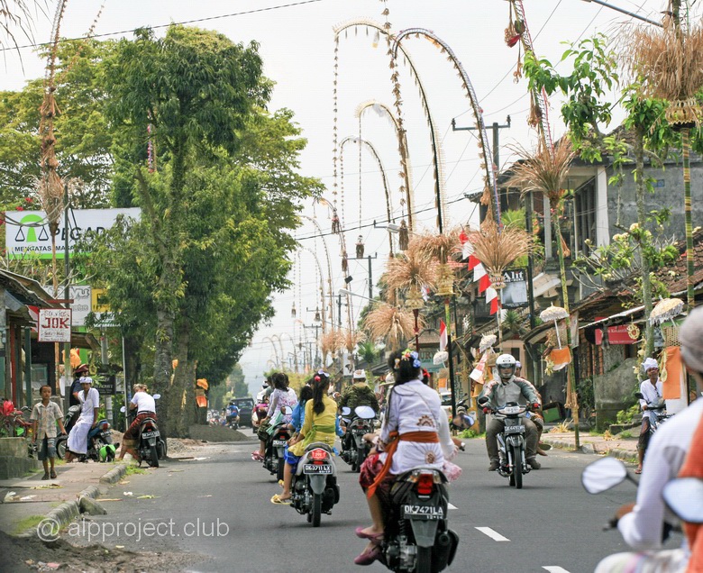
From the book "Bali Island", part 2 "Central part", episode 11.
8°30'39.06"S 115°15'36.11"E
A small town in the center of the island. It takes about an hour get to the beach. Along the road - there are shrines, luxury villas, all kind of shops and restaurants, exhibition and marketse of stone products.. Let's look at :-)
From the book "Bali Island", part 2 "Central part", episode 12.
8°31'7.50"S 115°15'30.95"E
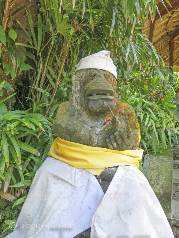
Balinese name of this place - Alas Kedaton. It is a natural reserve and the Hindu shrine complex. The place is sacred, it is even called the main attraction of Indonesia and living here primates are considered to be incarnations of the legendary warriors of the monkey king Hanuman. And they seem to know about his noble origin, behave themself completely relaxed, they are not shy of tourists and can easily tear of a beautiful trinket hanging around your neck or empty out your pockets. Yes it's true. :-) But in general they're quite friendly, make faces and beg for bananas, circus!
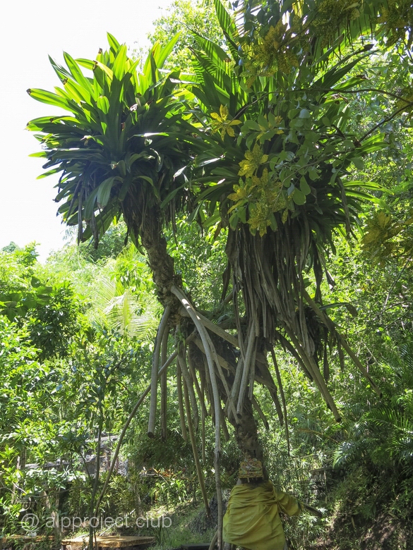
Big rubber plants protect you from the scorching sun, cool stream of clean water is hiding in the stones.. We'd liked his place :-)
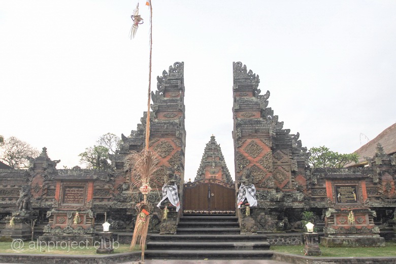
From the book "Bali Island", part 2 "Central part", episode 14.
8°34'54.96"S 115°16'33.74"E
The village of Batuan is located between Ubud and the island's capital – Denpasar city. It has long history, mentioned in historical documents of 1000 AD. It famous for its painting, ultimate painting in Batuan style – black-and-white image in the dark tones about a story of a mystical-religious sense.
The local Hindu temple complex dating from the 11th century.
From the book "Bali Island", part 2 "Central part", episode 15.
8°35'26.07"S 115°15'55.64"E
Every morning they organize performances for visitors with birds, snakes, monkeys, elephants and tigers. The birds were beautiful, snakes were dangerous, orangutans were smart. And they showed us even the whole play about the elephants - how in the beginning people were afraid of them and chased them away from houses, but one local boy drowned in the river, his inconsolable mother wept on the shore, but an elephant came and saved a drowning boy, then people and elephants lived in friendship here :-)
It's a wonder for kids here, they can ride on an elephant or camel and eat delicious ice cream. But we, the adults, had fun too, watching animal show and eating ice cream, we had saw enough hefty white tigers and then travel through the site on a live-aboard vessel special bus.
The Park is divided into three large enclosures in which animals live separately from three regions Indonesia, India and Africa. Antelopes, goats, zebras, bears, Komodo dragons, snakes, monkeys, cheetahs and lions – them all mixed up in our heads - bus was moving fast, just opened gates of the enclosures going to close, stops did not exceed 15 seconds, next bus with animal lovers behind us came quickly, and so on.. I pushed the shutter button of the camera, spanked portraits of living creatures, both good and blured, bridges-nets over streams (dividing the sector of pets) rumbled under the wheels of the jeep.. So fast and a lot of things appear, business don't like downtimes:-) And then we has lunch – a good buffet at the local restaurant, it was included in our travel pack.. :-)
Now, let's see what we've filmed:
From the book "Bali Island", part 3 "North-East", episode 16.
8°16'30.63"S 115°35'34.21"E
The North coast of Bali, Tulamben village. It is well-known cause sunken cargo ship of the U.S. army "USAT Liberty". It was hit by a torpedo of Japanese submarine in 1942. The ship was towed to the shore and for a long time it remained afloat, but in 1963 during the eruption of the Agung volcano it was covered by ash, it slid down cause overload, and now it lies under water on the sandy slope at depths from 8 to 30 meters. And now this whopper of a length of 125 meters is overgrowing by soft corals, fish live in the holds and just sticking barrels of the guns remind of war time. The wreck is well-known over the world, there is always a lot of divers here and accordingly a lot of bubbles.
The ship is big, it is impossible to shoot her general view, therefore, look at just the fragments..
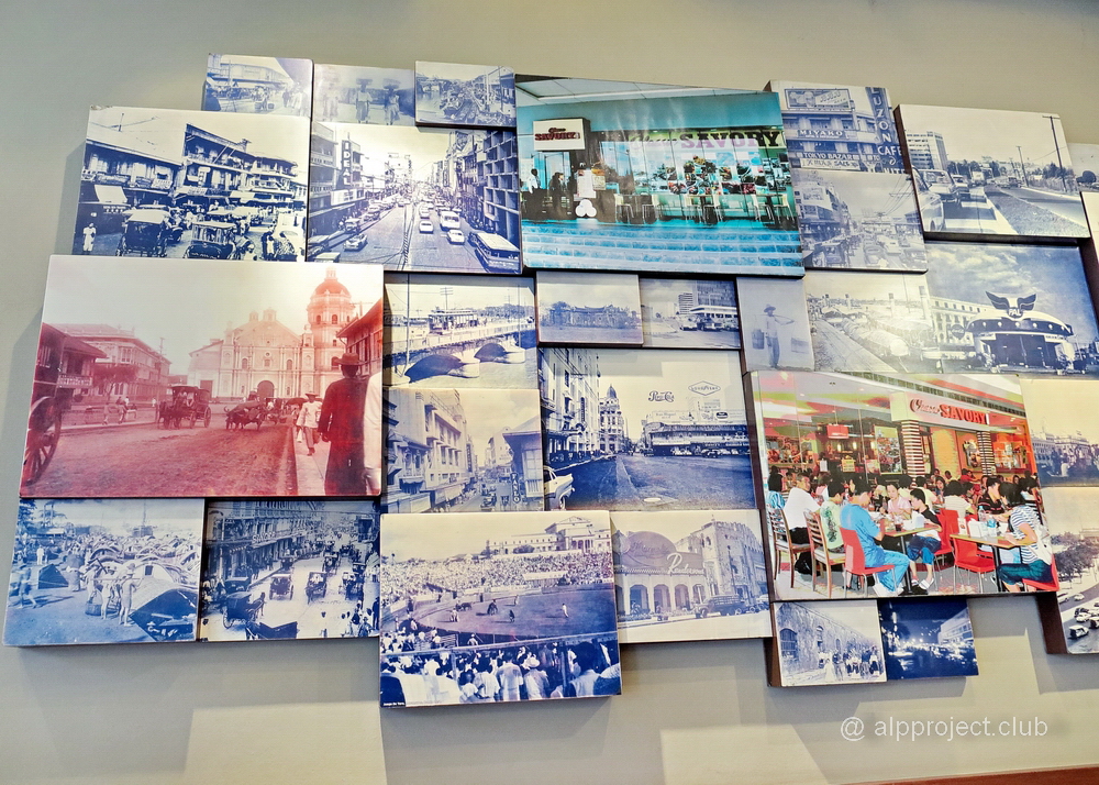
Wow: Manila the capital of the Philippines is just one of 16 cities that form the Metropolitan Region. It so happened that we were only in one of the cities of the conglomerate in Makati, so we have not 'seen the capital'. Makati population is 16th in the country, its population is slightly more than half a million residents. But if talk about importance it is, perhaps, one of the first not only in the Philippines but in Asia. It is a modern financial, commercial and economic centre, there are world famous research institutes here.. But we learned all this from Wikipedia later, and at the time of our travel we were surprised by modern architecture and lux hotels, because we imagined Manila a little different way - well, like on that old photo for example..
From the book "Puerto Galera. Roads of corsairs", episode 2.
There is northern part of the Gulf of Varadero, Coral Bay. There is a namesake dive hotel o the shore, small reef under water, consisting of hard and mostly soft corals (whole fields of them).
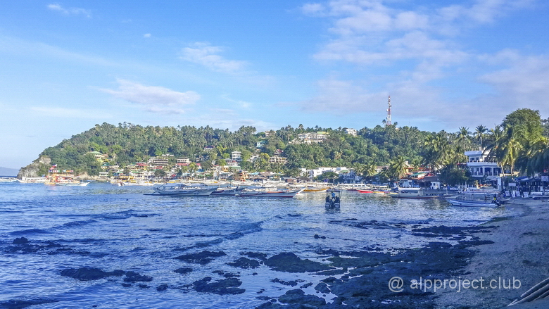
From the book "Puerto Galera. Roads of corsairs", episode 5.
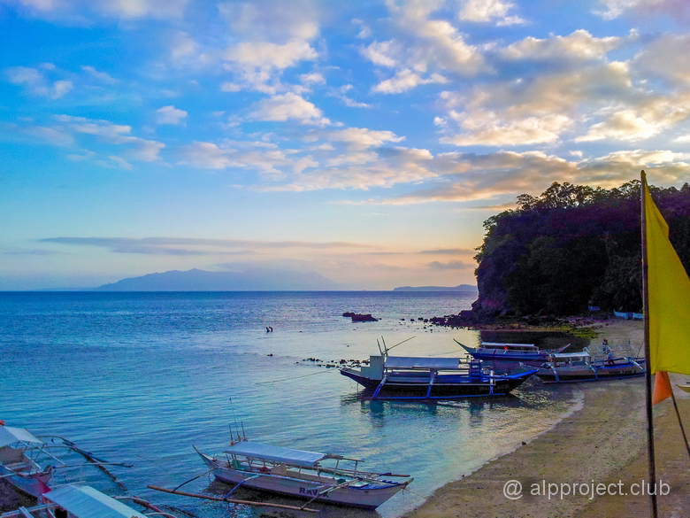
Life in Sabang depends on diving which is the main income here, not divers come here rarely. Coastal bay is spacious, all kinds of boats and small ships abound here.
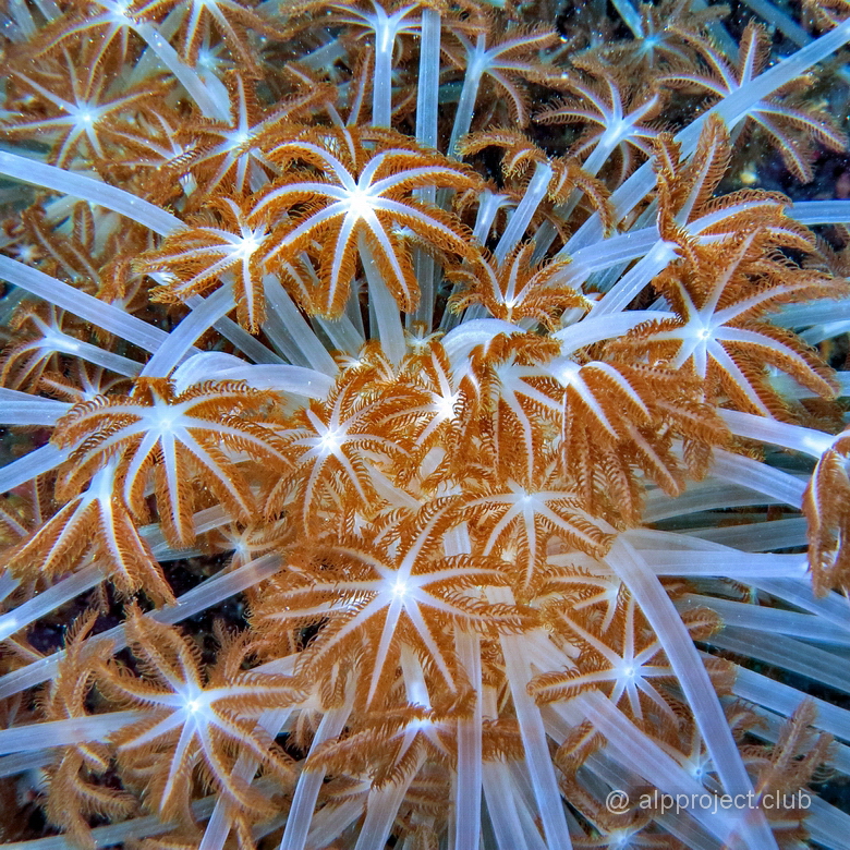
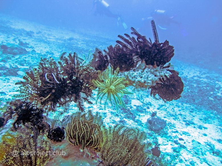
From the book "Puerto Galera. Roads of corsairs", episode 7.
There is theeef in the Eastern part of the Bay of Sabang. There are corals and a great variety of different crinoidea – sea lilies here. They are not plants as could seem at first glance, they are carnivores, one of the classes of echinoderms, one of the oldest species of fauna on our planet – their prints were found in ancient marine sediments, beginning from Ordovician period, about 500 million years! This time is enough for evolution, look how various they are..
The Muelle Bay in the Northern part of the large Philippine island of Mindoro and it locates at the crossroads of sea routes. Since the 16th century Spanish merchant ships often came here and for sure the Chinese traded here before the arrival of the Spaniards. Moro pirates robed over surrounding seas, they is known for their eagerness to fight and bloodthirstiness, that is why Spaniards had built several watchtowers and kept warships there.
We were here in February 2015 only a few days, so we don't pretend for completeness of the description of these places, we will tell you just about what happened to see.