
")
From the book "Bali Island", part 5 "East", episode 25.
8°31'49.45"S 115°30'52.18"E
A small bay on the Eastern side of the cape, covering Padang Bay from the sea - East Bali sea gate. At the bottom of it the sand and volcanic rock wall. It was unclear inside, but we saw someone under water. At first, there were the ribbon eels there. They are rare, but but we found there black one and blue with bright yellow piping.. They pleased us :-) And the green black-spotted moray eel was there, quite large one. And nudibranches were there, however, quite common species. Also I fimed two cuttlefish, the first one was sleepy, but the second one was chipper and perky :-) Watch the movie:
From the book "Bali Island", part 4 "South-East", episode 24.
8°45'36.87"S 115°10'8.68"E
The beach stretches 4 kilometers to the South of the airport. In day time you can have a lot of fun her – parasailing, jet skis, riding on "banana" or on strange jumping inflatable mattress towing by high-speed boat, snorkeling and even scuba diving in so-so coral reefs and so on.
At night the restaurants on the beach gather lovers of fresh seafood. They installs tables-chairs right on the sand just beyond the line of the surf, the spray of ocean waves – a condiment for food, sound of ocean waves - music accompaniment, and the huge setting sun instead of chandeliers. Something like that..
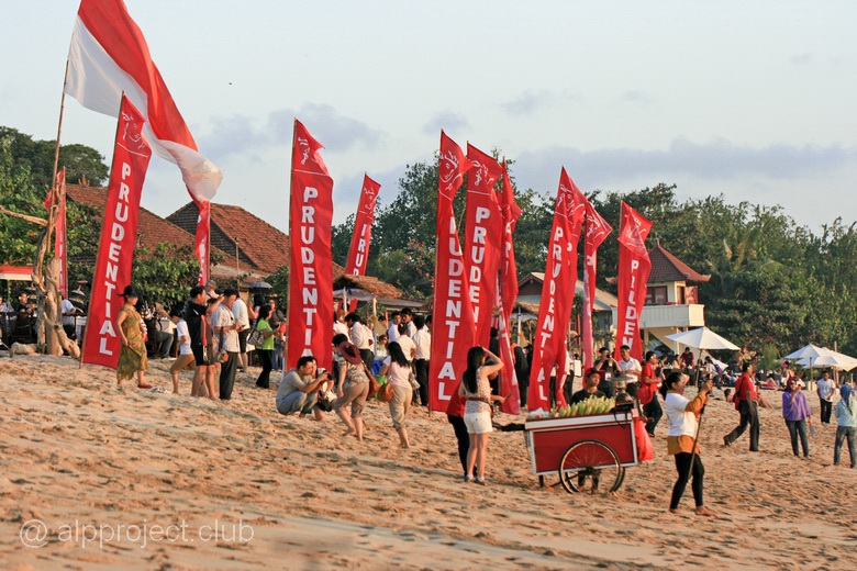
Evening on the beach of Jimbaran
From the book "Bali Island", part 4 "South-East", episode 23.
8°49'48.92"S 115° 5'11.88"E
The Bukit Peninsula is situated at the South-East of Bali and is washed by the open ocean. There are a district of South Kuta and Pecatu village on it, Uluwatu Temple is situated next to them.
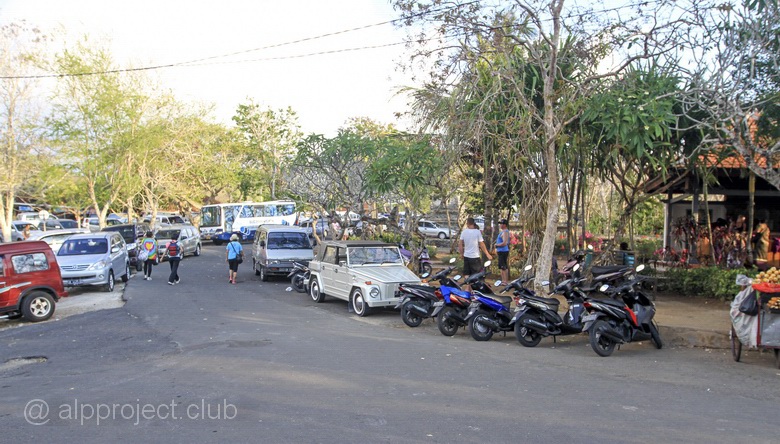
Parking at the entrance to the temple complex
From the book "Bali Island", part 4 "South-East", episode 22.
8°42'0.29"S 115° 9'48.50"E
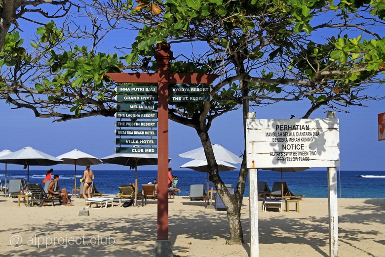
There are chain of three resort towns - Kuta, Legian adn Seminyak- in the South-Eastern part of Bali island, along the beach, which is washed by the huge waves of the Indian ocean. They practically merge with the island's capital Denpasar city, it is difficult to determine the boundaries. In addition, Kuta beach is located near the international airport and the beaches are fantastic – white soft sand and huge waves, and in 1936 the couple of Americans, Robert and Louise Kwak, had built the first hotel here. Then others did the same, and poor fishing village gradually turned into a huge resort agglomerate. Popularity of this place was increased due to the surfers and hippies from Australia and Europe, and Kuta became the object of pilgrimage since the late 60-ies of XX-th century. In those years they spoke of three K: Kathmandu in Nepal, the Khoasanstreet in Bangkok (for a different version of Kabul in Afghanistan) and Kuta in Bali. Hippies fueled with coke in the first two points and then they had completed their journey in Bali in the lean dry season.
Now Kuta has countless shopping stalls, shops, small family hotels and the coastal line is built out with adjacent one to another hotels, restaurants, night clubs.
From the book "Bali Island", part 3 "North-East", episode 21.
8°22'51.21"S 115°38'8.77"E
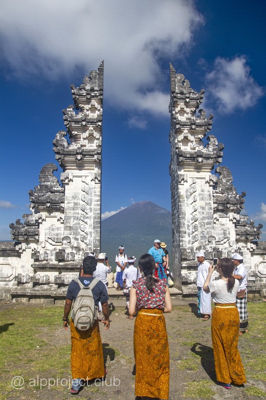
The mountain (Seraya volcano) is located in the Eastern part of the Bali island, the peak has height of 1058 meters above sea level. The place, of course, is sacred, there are 7 levels of shrimes on the Northern slope up to the top of the mountain and they all are joined by steep stairs. This temple complex is one of the oldest on the island (2000 years), its construction was started in pre-Hindu times. It stretched out as 2 km on the hillside, stairs have a total of 1700 steps. The ascent route offers to you wonderful views of the jungle on the mountain slopes and the blue sea and the cone of the volcano Agung - the highest point on Bali.
From the book "Bali Island", part 3 "North-East", episode 20.
8°18'54.83"S 115°37'31.49"E
The North coast of Bali, the place is near of Amed village, a small bay with a dive hotel on the beach. The bay is private property: if you come from the sea by diving boat, you will be given a ticket, which must be paid later, otherwise it will be a violation of the local laws. You have to pay because the place is popular, there are rare scorpionfish (Rhinopias aphanes), frog-fish and all sorts of other unusual sea creatures. We were unlucky about such scorpionfish, but we've seen someone. The first place, of course, was for scorpionfish – there is their Kingdom here..
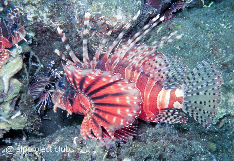
Lionfish Parapterois heterura
From the book "Bali Island", part 3 "North-East", episode 19.
8°20'2.24"S 115°39'21.54"E
THis place was ten minutes on a motor boat to the East from the Amed Beach Resort hotel. We fell into the water from a boat.
From the book "Bali Island", part 3 "North-East", episode 18.
8°20'2.96"S 115°38'34.44"E
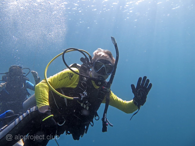
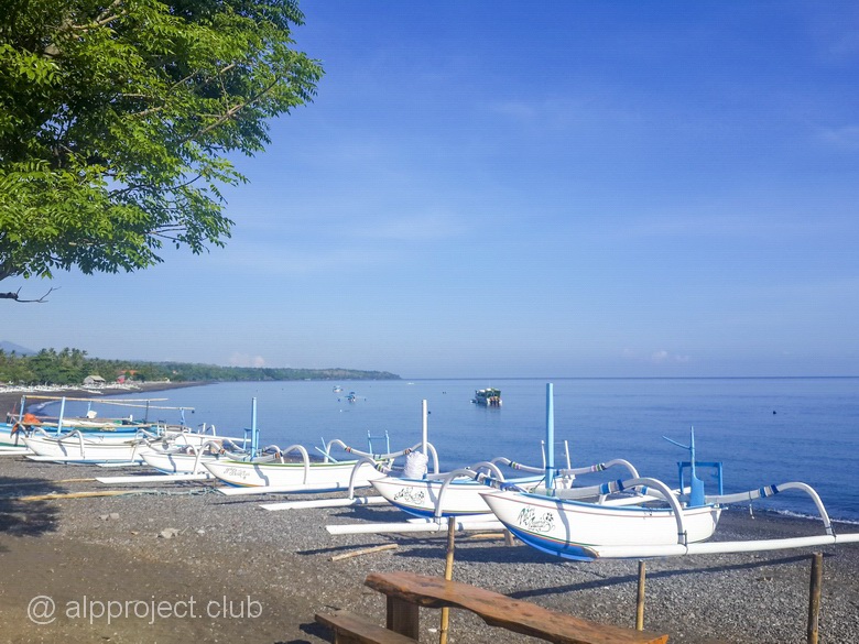
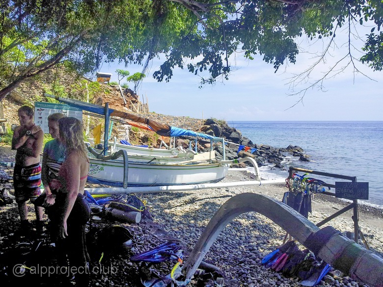
Northeast of Bali, Amed village. We stayed here in January 2016, a few days in a small dive hotel, cosy and welcoming. Unlike other places in Bali, it was possible to swim in the sea not only in pool, because there is no crazy waves as on the southern beaches of the island and there was pebble ground from beach to the sea, not rough corals as in the East. The water was warm and clean, it was quiet and peaceful place, no crowds of tourists and the surroundings were beautiful, especially early in the morning – splendor! :-)
From the book "Bali Island", part 3 "North-East", episode 17.
8°21'51.63"S 115°42'1.55"E
The North-Eastern end of Bali, the town of Banyuning, a small bay near the fisher's village of Lipah. There is Badung Strait near, it separates Bali island from the group of islands lying to the East, the largest of which is the island of Nusa Penida. Diving here, you have to be careful in order not to be captured by powerful currents which can carry you either to the North of Bali sea, or to the South to the Indian ocean right to Australia and even Antarctica – as lucky you are:-)
From the book "Bali Island", part 1 "West", episode 5.
8° 5'25.54"S 114°29'53.99"E
The North-Western end of the island. There is a sunken boat here at a depth of 30-40 metres. Its story is vague, no one really knows about it and there are only fragments at the bottom. One lonely shy whitetip shark lives here who did not allow us to swim closer, so we failed to make a portrait, but you can see it in the movie. We made some photos and movies at depth and moved slowly upward along the coral wall, moving to the west by current. We met something by the way, look at the movie..
From the book "Bali Island", part 1 "West", episode 4.
8° 5'56.03"S 114°31'34.28"E
The South-Eastern wall of Menjangan reef. The water was really hot, some cold jets made us happy. Tangible, sometimes even very tangible, currents constantly change their direction, and we drifted there and back.
From the book "Bali Island", part 1 "West", episode 3.
8° 5'37.82"S 114°29'46.01"E
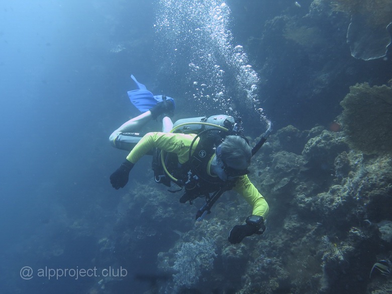
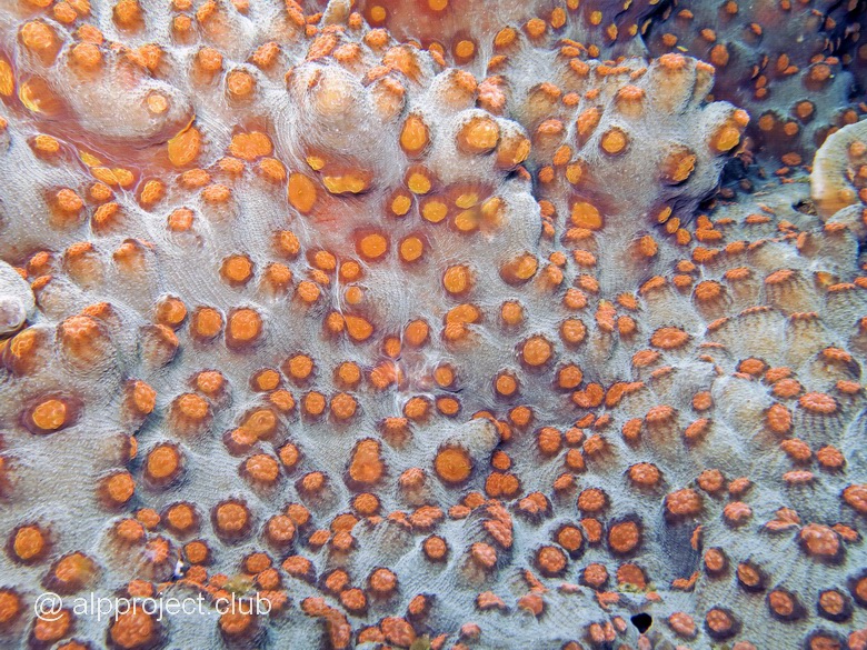
Menjangan island is part of the National Park Barat. There are several dive sites around, they called the best diving points of Bali. We dived at few of them and we describe it here and at the following pages. The island is overgrown with coral plateau, the edges go steeply to a depth about 60 meters, and then a gently sloping sandy bottom is there. But we have not tested it, we have dived 25 metres down only and then went up along the wall, examining the coral and looking for something rare. Despite the name of Eel Garden we saw no eels, not even usual moray. There were just corals and sea lilies there, somewhere nudibranchs, nothing extra.
From the book "Bali Island", part 1 "West", episode 2.
8° 5'33.71"S 114°31'35.86"E
A small coral Menjangan island is located as far as 30 minutes by motor boat from the Northwest coast of Bali. Nobody lives here constantly, local people come here for a daytime to visit number of temples, one of them is even the Chinese pagoda. During the break between dives we visited one of them.

From the book "Bali Island", part 1 "West", episode 1.
8° 8'55.40"S 114°39'35.97"E
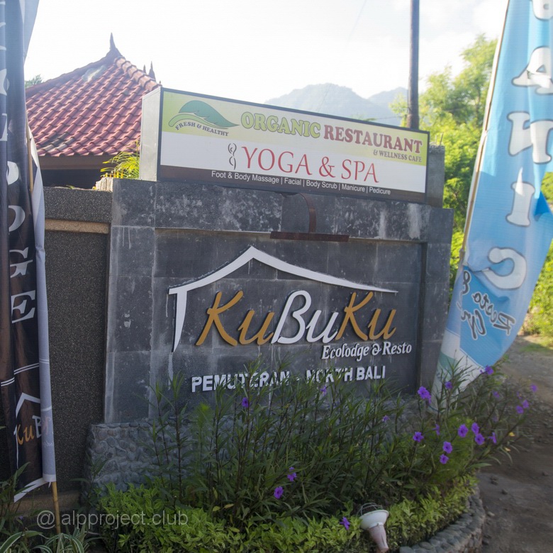
There is North-West Bali, the location is most remote from the capital and airport, so not everyone been here. The beaches here are so-so, villages are not rich. People are busy gardening, fishing and, of course, the service for tourists. We lived here in a little, just a few houses, the Kubuku hotel (Kubuku Ecolodge & Resto). It is located inside of the Pemuteran village, it is about 1.5 km from the coast of the sea. There are a swimming pool, well-kept grounds and friendly staff here.
From the book "Bali Island", part 1 "West", episode 6.
8° 5'28.97"S 114°30'14.62"E
It is the North-West end of Menjangan again, about 650 metres to east from previous dive site Anchor Wreck. In fact, it is the same wall of coral reef which surrounding the island. We swam the same way along the wall downstream to the west, and we saw almost the same corals and fish. Clownfish were cute on anemones, one parrotfish was catched by our camera.. The sea is open up to the Java island there and quite perceptible currents bring a lot of plankton, water was blurred. Look what we managed to film: