Bali. Nusa Penida. Along the flow: dive site Ped
From the book "Bali Island", part 6 "Nusa Penida", episode 32.
8°40'30.00"S 115°30'52.80"E
Nusa Penida island is located closer to Lombok island then to Bali. But we will describe it in this section because almost all dive centers in Bali do arrange diving and snorkeling here, lovers of underwater world spend 20 minutes to come here by speedboats from the Padang Gulf.
Drift along a gentle underwater wall on the North of Nusa Penida island. Our georeference is arbitrary – you can come much East or West – the essence remains the same: all the dive will be along the flow. We had short stops during the dive for shooting the main attractions of this site – corals and fish scurrying around them..
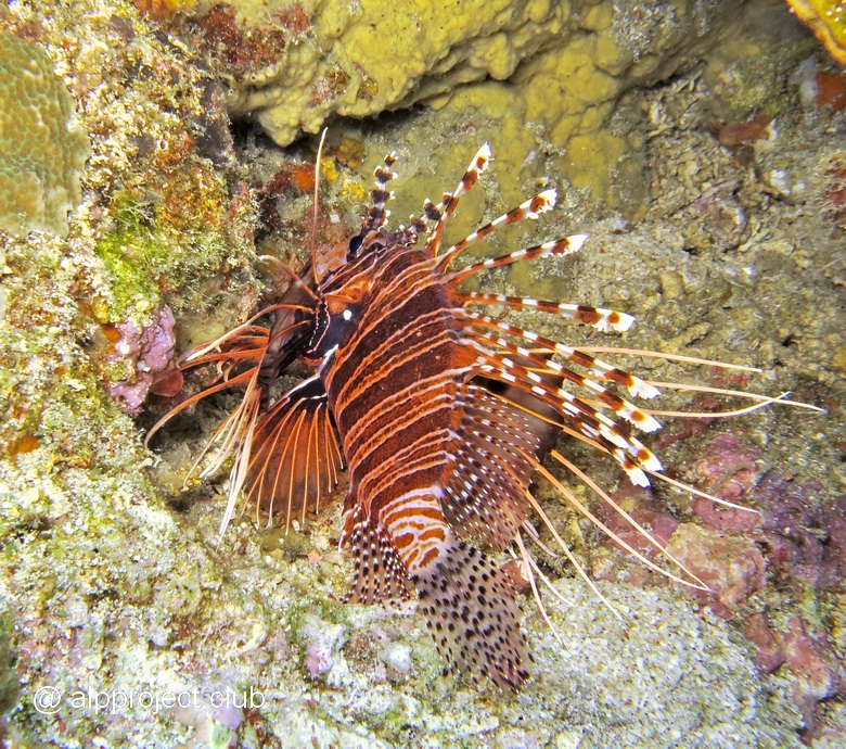
Lionfish
Bali. Who lives under the pier: the sea port Tanah Ampo
From the book "Bali Island", part 5 "East", episode 31.
8°30'29.81"S 115°31'8.07"E
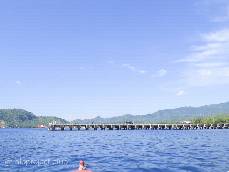
Tanah Ampo – sea port in the East of Bali, large cruise ships come here from Singapore and Australia. But we are interested by the pier, there are a lot of unique characters under it.
Bali. Against the tide: Gili Mimpang
From the book "Bali Island", part 5 "East", episode 30.
8°31'30.58"S 115°34'34.98"E
Три крохотных островка рядом с Типиконгом, октябрь 2016 года. Годом раньше наши гиды встречали здесь рыбу-луну – мола-мола, но в этом году вода осенью была необычно тёплой, что гигантской рыбе не по нраву, она предпочитает прохладу.
Мы ныряли тут лишь один раз, весь дайв боролись с сильным течением. Не фотографировали, есть лишь видео. Персонажи в нём все известные, представлять никого не надо. Давайте понаблюдаем за ними: There are three tiny islands near Tepekong, October 2016. The year before our guides met here moon fish – Mola-Mola, but in this year the water was unusually warm that the giant fishes does not like, they prefer the coolness.
We dived here only once, the whole dive we were struggling with strong current. No photos, we got only video.All the characters in the movie are well known, it is not necessary to discribe anyone. Let's watch them:
Bali. Sea of corals: Gili Tepekong
From the book "Bali Island", part 5 "East", episode 29.
8°31'54.62"S 115°35'13.26"E
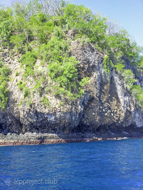
Tepekong is the largest of the islands in the sea opposite the village of Candidasa. We'd dive near it three times – once in January and twice in October 2016. Probably it is the richest place of corals in this area. It is a rock of volcanic lava and reef limestone on the surface, it is covered with green bushes.
Bali. Shark in the hole: divesite Gili Biaha
From the book "Bali Island", part 5 "East", episode 28.
8°30'34.82"S 115°36'52.87"E
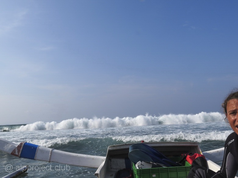
We are overcoming the line of the surf on the boat and going from our hotel Bali Santi Bungalows along the coast to the East.
Bali. To escape the bustle: Candidasa village
From the book "Bali Island", part 5 "East", episode 27.
8°30'24.95"S 115°33'38.06"E
Candidasa (or Chandidasa which is closer to local pronunciation of this name) is a fishing village gradually turning into a resort because development of tourism. The main street of the village stretches for 2-3 kilometers along the sea and almost all hotels, shops and restaurants located near to it. The beaches near the hotels and villas are mostly stony, resting people swim in pools but snorklers and divers take boats to nearby small islands overgrown with coral reefs. We are divers, therefore, we almost had no time to survey the settlement and the surrounding area, except the evenings when we visited some vending restaurants. The rest of the time we admire the hotel Bali Santi Bungalows. It is inexpensive and quite nice - take a look:
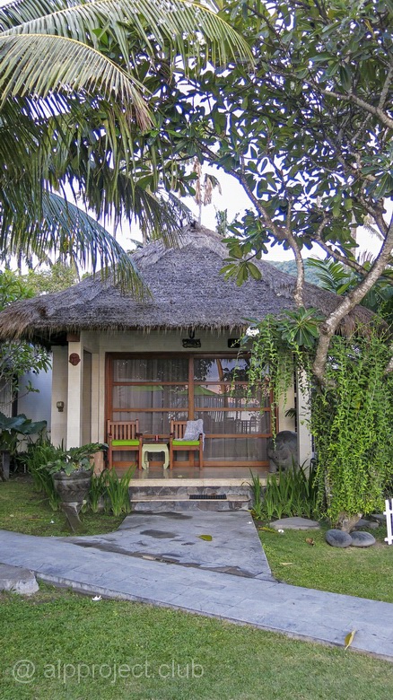
Bungalow
Bali. The muddy waters of Padang: the dive site Jepun Point
From the book "Bali Island", part 5 "East", episode 26.
8°31'40.44"S 115°30'52.39"E
300 meters to the North from the Blue lagoon along the coast.
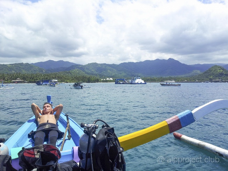
Bali. Padang, dive site Blue lagoon
From the book "Bali Island", part 5 "East", episode 25.
8°31'49.45"S 115°30'52.18"E
A small bay on the Eastern side of the cape, covering Padang Bay from the sea - East Bali sea gate. At the bottom of it the sand and volcanic rock wall. It was unclear inside, but we saw someone under water. At first, there were the ribbon eels there. They are rare, but but we found there black one and blue with bright yellow piping.. They pleased us :-) And the green black-spotted moray eel was there, quite large one. And nudibranches were there, however, quite common species. Also I fimed two cuttlefish, the first one was sleepy, but the second one was chipper and perky :-) Watch the movie:
Bali. Dinner with a sunset view: Jimbaran beach
From the book "Bali Island", part 4 "South-East", episode 24.
8°45'36.87"S 115°10'8.68"E
The beach stretches 4 kilometers to the South of the airport. In day time you can have a lot of fun her – parasailing, jet skis, riding on "banana" or on strange jumping inflatable mattress towing by high-speed boat, snorkeling and even scuba diving in so-so coral reefs and so on.
At night the restaurants on the beach gather lovers of fresh seafood. They installs tables-chairs right on the sand just beyond the line of the surf, the spray of ocean waves – a condiment for food, sound of ocean waves - music accompaniment, and the huge setting sun instead of chandeliers. Something like that..
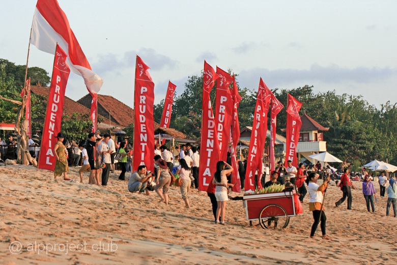
Evening on the beach of Jimbaran
Bali. On the edge of the ocean: Uluwatu temple complex
From the book "Bali Island", part 4 "South-East", episode 23.
8°49'48.92"S 115° 5'11.88"E
The Bukit Peninsula is situated at the South-East of Bali and is washed by the open ocean. There are a district of South Kuta and Pecatu village on it, Uluwatu Temple is situated next to them.
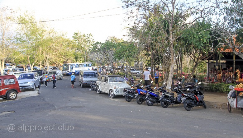
Parking at the entrance to the temple complex
Bali. The legend of Bali - beaches of Kuta
From the book "Bali Island", part 4 "South-East", episode 22.
8°42'0.29"S 115° 9'48.50"E
There are chain of three resort towns - Kuta, Legian adn Seminyak- in the South-Eastern part of Bali island, along the beach, which is washed by the huge waves of the Indian ocean. They practically merge with the island's capital Denpasar city, it is difficult to determine the boundaries. In addition, Kuta beach is located near the international airport and the beaches are fantastic – white soft sand and huge waves, and in 1936 the couple of Americans, Robert and Louise Kwak, had built the first hotel here. Then others did the same, and poor fishing village gradually turned into a huge resort agglomerate. Popularity of this place was increased due to the surfers and hippies from Australia and Europe, and Kuta became the object of pilgrimage since the late 60-ies of XX-th century. In those years they spoke of three K: Kathmandu in Nepal, the Khoasanstreet in Bangkok (for a different version of Kabul in Afghanistan) and Kuta in Bali. Hippies fueled with coke in the first two points and then they had completed their journey in Bali in the lean dry season.
Now Kuta has countless shopping stalls, shops, small family hotels and the coastal line is built out with adjacent one to another hotels, restaurants, night clubs.
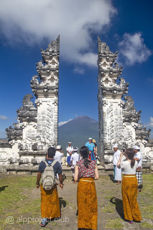
Bali. Lampuan temple (Seraya volcano)
From the book "Bali Island", part 3 "North-East", episode 21.
8°22'51.21"S 115°38'8.77"E
The mountain (Seraya volcano) is located in the Eastern part of the Bali island, the peak has height of 1058 meters above sea level. The place, of course, is sacred, there are 7 levels of shrimes on the Northern slope up to the top of the mountain and they all are joined by steep stairs. This temple complex is one of the oldest on the island (2000 years), its construction was started in pre-Hindu times. It stretched out as 2 km on the hillside, stairs have a total of 1700 steps. The ascent route offers to you wonderful views of the jungle on the mountain slopes and the blue sea and the cone of the volcano Agung - the highest point on Bali.
Bali. Amed, dive site Batu Belah
From the book "Bali Island", part 3 "North-East", episode 20.
8°18'54.83"S 115°37'31.49"E
The North coast of Bali, the place is near of Amed village, a small bay with a dive hotel on the beach. The bay is private property: if you come from the sea by diving boat, you will be given a ticket, which must be paid later, otherwise it will be a violation of the local laws. You have to pay because the place is popular, there are rare scorpionfish (Rhinopias aphanes), frog-fish and all sorts of other unusual sea creatures. We were unlucky about such scorpionfish, but we've seen someone. The first place, of course, was for scorpionfish – there is their Kingdom here..
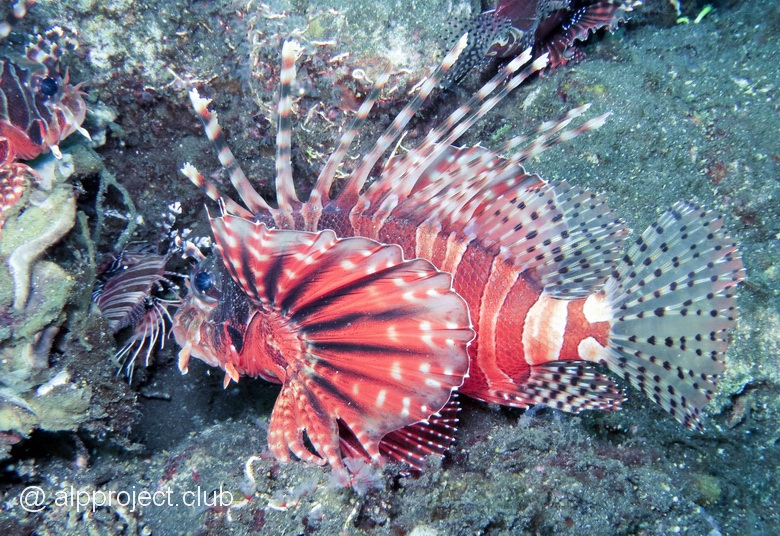
Lionfish Parapterois heterura
Bali. Amed, dive site Bobo (Pyramids)
From the book "Bali Island", part 3 "North-East", episode 19.
8°20'2.24"S 115°39'21.54"E
THis place was ten minutes on a motor boat to the East from the Amed Beach Resort hotel. We fell into the water from a boat.
Bali. Amed, Amed Beach Resort
From the book "Bali Island", part 3 "North-East", episode 18.
8°20'2.96"S 115°38'34.44"E
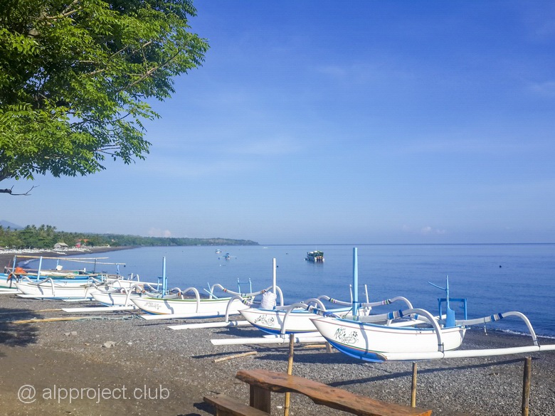
Northeast of Bali, Amed village. We stayed here in January 2016, a few days in a small dive hotel, cosy and welcoming. Unlike other places in Bali, it was possible to swim in the sea not only in pool, because there is no crazy waves as on the southern beaches of the island and there was pebble ground from beach to the sea, not rough corals as in the East. The water was warm and clean, it was quiet and peaceful place, no crowds of tourists and the surroundings were beautiful, especially early in the morning – splendor! :-)
Page 5 of 11


